 Into the Wild
by Dr. Markus Eßer
(photos by the author, drawings by Corinna Esser)
Photo-Video Equipment:
Underwater Photography and Filming: Camera: Sony HDR SR12E, Video housing: BS Kinetics: Sonoran, Lighting:
WERNER LED ring light 36W, WERNER LED paneel WLED 60W
Landscape Shots: Camera: Canon EOS 400 D, Lenses: Canon EF 50mm 1:1.8 II, Canon EF S 18-55 mm 1: 3.5 – 5.6 IS
Tamron AF 55-200 mm 1.4-5.6, Canon EF 70-300 mm F 4 – 5.6 IS USM
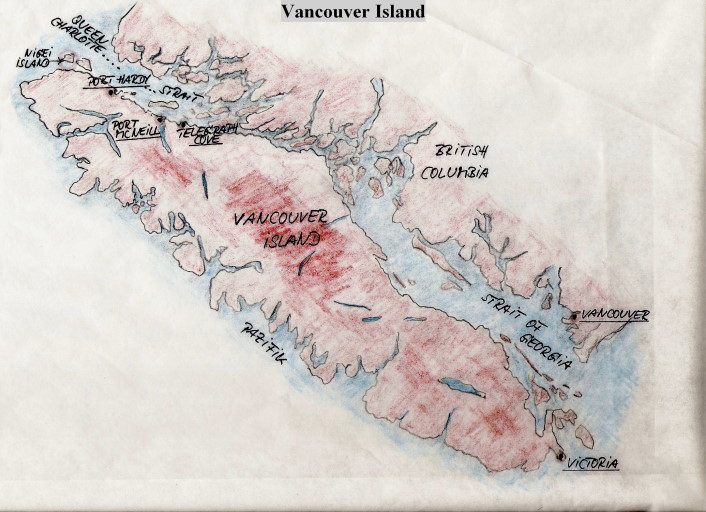
My journey ‘into the wild’ and unspoiled nature that surrounds beautiful Vancouver Island, British Columbia started on August 12, 2011. This journey took me to Queen Charlotte Strait, a necklace of islands in which the penultimate island is called Nigei Island. And here, in a well sheltered bay of Nigei Island is my ultimate destination – Clam Cove.
My journey:
After a long flight with multiple stops in North America, I finally arrived at the International terminal of Vancouver International Airport on southern Vancouver Island. There I collected my luggage and caught a shuttle bus to the South Terminal.
Upon arriving at this small airport, it was evident the clocks were ticking differently and the journey’s beat had changed and begun to slow down.
The “Discovery of Slowness” by Sten Nadolny came to my mind, however it was the discovery of tranquility that was also a touching experience for a Western European.
My flight to Port Hardy, on the Northern end of Vancouver Island, departed with a twin engine amphibious plane. Thanks to the low flying altitude, I could get a first impression of the wonderful landscape of British Columbia. I saw seemingly endless forests which showed no signs of civilization.
Once in Port Hardy, I spent my first night at the Providence Place Inn. After breakfast the following morning, I went to the marina and waited for John Deboeck to pick me up at the rendezvous location.
In earlier days, whaling ships left Port Hardy to chase and kill the gentle giants. But now, after the forestry industry, whale watching and eco-tourism is the next important source of income for the region.
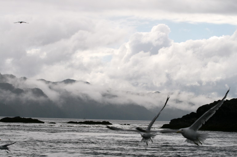
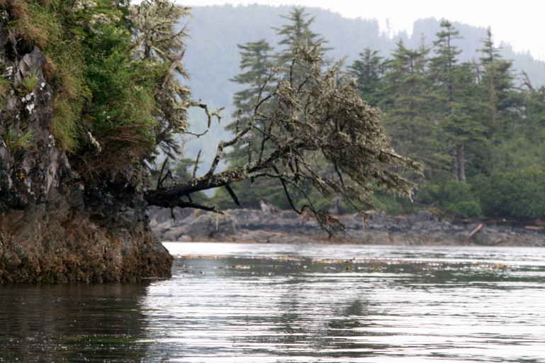
Right at 12 am., John and his boat became visible through the white fog. We quickly stowed the diving gear, filled the fuel tank and then drove about 90 minutes through the Queen Charlotte Strait to Clam Cove. Our wonderful trip, accompanied by sea birds and whales, went through unspoiled nature, passed uninhabited islands, and along majestic forests on the shore that hid many endangered animal species. If we could understand the forests, they would tell the story of the Haida culture.
Where we are – British Columbia:
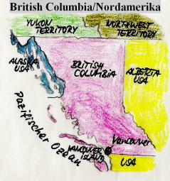
British Columbia is a Canadian province bordered by the Pacific Ocean on the west, by the state of Alaska on the northwest as well as parts of the west, on the north by the Yukon and the Northwest Territories, on the east by the Province of Alberta, and on the south by the U.S. states of Washington, Idaho and Montana.
The capital of British Columbia is Victoria, located on the southeastern tip of Vancouver Island.
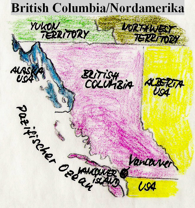
After Quebec and Ontario, British Columbia is the third largest province in Canada with an area of 944,735 km2. In 2009, British Columbia had an estimated population of 4,419,974, which is 13% of Canada’s population with a resulting population density of 4.7 inhabitants per km2. The majority of the population lives in the southwest part of the province.
The province’s largest city and economic center is Vancouver, which is not on Vancouver island but rather is located in the southwest corner of the lower mainland.
Vancouver, with the ocean on one side and the snow-capped mountains on the other side, is also a worthwhile holiday destination but will have to be a topic for another travel report. Apart from the southeastern tip of Vancouver Island, the other parts of the island are characterized by numerous mountain ranges and are thinly populated.
Queen Charlotte Strait
Queen Charlotte Strait is a strait between the northern tip of Vancouver Island and the mainland of British Columbia.
Queen Charlotte Sound was named by James Strange on August 5, 1786 in honor of Queen Charlotte, the consort of King George III. Strange was the leader of a fur trading expedition consisting of two ships, The Captain Cook under Captain Henry Lawrie, and the Experiment under Captain John Guise. During a boat excursion up Goletas Channel, Strange saw an opening ahead and named it Queen Charlotte Sound. The body of water he named is today known as Queen Charlotte Strait.
Since 2009, the islands ot the same name, in the Hecate Strait north of the Queen Charlotte Strait no longer bear their colonial name, but instead use the name given to them in the language of the Haida people – “Haida Gwaii.”
The Haida are one of the Indian tribes which are referred to as First Nations in Canada. Their history goes back around a thousand years, and as a result they represent one of the oldest stationary populations in the world. About half of the approximately 5,000 First Nations residents of Vancouver Island belong to the Haida. Their population was greatly diminished with the smallpox epidemic of 1862.
The islands are the home of a variety of rare and endemic species. For example, the largest sub-species of American black bears (Ursus americanus carlotta) live here, and there are protected areas for mare than 140 bird species. In addition, many types of trees, such as the coastal pine, American red alder, and the Western red cedar can be found here.
Nigei Island, Clam Cove
The second largest of the mostly uninhabited islands between Vancouver Island and the mainland of British Columbia is Nigei Island. And in Clam Cove, at the southern end of the island, is my temporary home which is known as a float camp. Such rafts were once used by loggers or fishermen who required a mobile home.
Now this particular camp with its additional huts is moored and well protected in Clam Cove and has become an ideal base for exploring the Queen Charlotte Strait. Just a few minutes from the float camp is the legendary dive site known as Browning Wall which has been described by Jacques Cousteau as the world’s best cold water dive site and the world’s second best dive site overall. Browning Wall is listed as one of the best dive sites in the world in all dive guides.
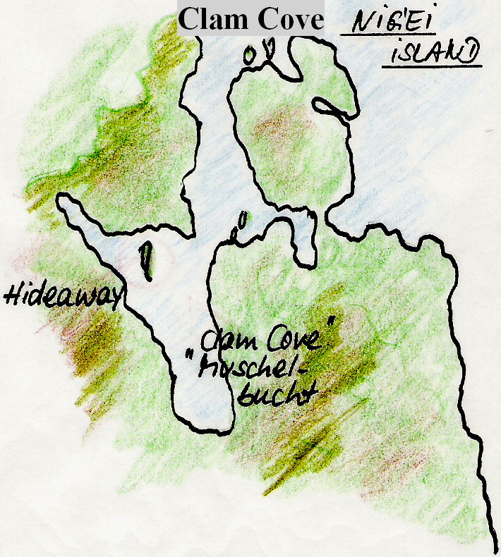
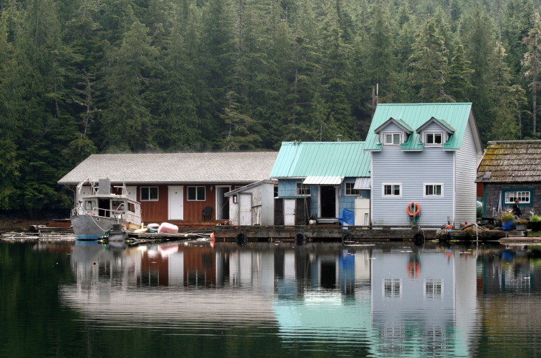
Our floating camp is known as the “Hideaway” and consists of several firmly anchored rafts on which the individual cabins are housed (compressor/workshop cabin, “Bunk House” with living and dining room, central kitchen with staff sleeping quarters, firewood shed, and our two-story house with separate generator). The whole complex is well protected in Clam Cove and is not visible from the open sea.
Why are the dive sites around Browning Wall so spectacular? Why is there such a diverse variety of species here?
Like any other biotic communities, marine communities need food. The marine food chain is regulated by the primary production of microalgae. For building biomass, the microalgae needs nutrients which usually accumulate on the ocean floor at the end of their life cycle in the ocean and are usually inaccessible in these deep, cold waters.
Why is this different in some areas, in the so-called upwelling areas?
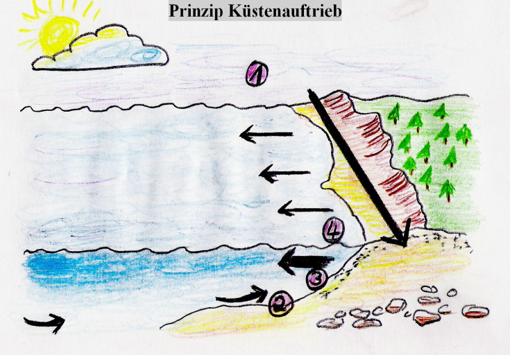
Upwelling Areas:
1) Northerly winds drive surface water away from the shore
2) Oxygen-poor water is sucked to the surface through upwelling
3) This deep water rich in nutrients fertilizes phytoplankton (plankton bloom)
4) As a result, near year-round growth of phytoplankton is possible
Upwelling means the rising of water in oceans, seas and lakes from deeper layers to the shallow, light-filled surface where plant growth takes place. The water in the deeper layers is generally colder and richer in nutrients than the surface layer of water. Upwelling therefore leads to a cooling and enrichment of the surface water.
The classical upwelling regions are found where the surface water is driven away from the coast, and to compensate water from the depths has to flow in or ‘upwell’. In the upper sun-filled surface layer, there are now better conditions for high primary production.
Everyone swimming in the ocean can feel the difference in water temperature when the wind is blowing from the mainland and when it is blowing from the sea. The large-scale upwelling areas do not result from offshore winds but from winds blowing parallel to the coast which move immense amounts of water away from the coast. Responsibility for this lies with the centrifugal force of the Earth’s spin, also known as the Coriolis Effect.
Due to the planetary circulation, there are only certain areas on Earth where permanent or seasonal upwelling can be stimulated. Coastal upwelling areas are common to the west coasts of continents in the area influenced by the trade winds.
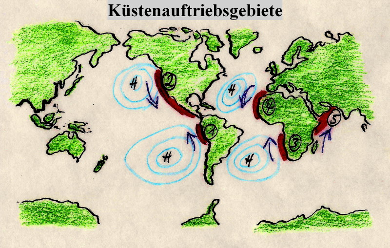
1. Humboldt Current
2. California Current
3. Benguela Current
4. Canarian Current
5. Somalia Current
As mentioned above, the nutrients in the deep water have an important effect on the marine biotic community.
Deep waters are rich in nutrients, including nitrate and phosphate, as a result of sinking, decomposing organic matter from surface waters. When brought to the sunlit surface, the euphotic zone, these nutrients are used by phytoplankton, along with dissolved CO2 and light energy from the sun, to produce organic compounds through the process of photosynthesis. Upwelling regions, therefore, result in very high levels of primary production (the amount of carbon fixed by phytoplankton) in comparison to other areas of the ocean. This high primary production, with phytoplankton at its base, propagates up the oceanic food chain.
It forms the nutrient source for the entire food cycle, from zooplankton (microscopic crustaceans, etc.) to fish, turtles, sharks and whales, and humans. Therefore the population density of higher species of the marine ecosystem in permanent upwelling areas is quite large. These upwelling areas with extremely high biomass production rates have a significant economic importance. Nowhere else in the world is the density of marine mammals higher than in the area around Vancouver Island.
Cold water areas are home to a huge variety of life. On one hand, the creatures appreciate the cold uprising water, and on the other hand they benefit from the high amount of nutrients in the water. The plant and animal species in these cold waters are perfectly adapted to the prevailing conditions, but they are also very sensitive to changes in their habitat.
Driven by the Tide:
In addition to this vertical movement of water around Vancouver Island’s Queen Charlotte Strait, there is also a large horizontal shift of water masses, which combines to create some of the largest tidal range in the world. By channeling these waters the effects are further magnified.
The Skookumchuck Narrows are a magnificent tidal stream in British Columbia. Skookumchuck is a word in Chinook Wawa, a former language of commerce in the America-Canada Pacific and consists of skookum = strong, wild, and chuck = water. Tidal currents are compensating currents of the sea, resulting from a change of the tide. Thanks to the strong currents surrounding Vancouver Island, various tidal power stations have been developed as demonstration projects.
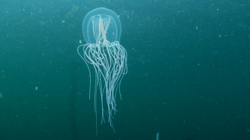
Tidal currents with a speed of up to 16 knots can occur in certain areas of Vancouver Island. For this reason, you should only dive in certain areas with a professional guide, at slack, with proper training, and with the use of current tide tables.
Diving in Paradise:
For this reason, and after the advice of the team at Cooldives.com, I entrusted myself with the legendary John Deboeck, a friend of whale researcher and Greenpeace activist, Dr. Paul Strong. John is the owner of the Browning Pass Hideaway Resort in Clam Cove which proclaims the motto “the best diving in the known universe”.
The diving at Browning Wall was amazing and is very addictive! The sight of this drop-off took my breath away, and the diversity of marine life and the richness of colors is stunning.
I have dived at numerous sites around the world including other cold water dive sites, but seeing all this life was unbelievably beautiful. As a marine biologist I am familiar with many cold-water species but here, they seemed to be different – bigger and more colorful than anywhere else.
The gloriously colorful vertical wall is rightly titled ‘the Mecca of cold water diving’ and it welcomed me in full splendor – orange and white anemones, red soft corals, and yellow sponges sprout everywhere. The rock underneath could barely be seen anywhere. And in between all the color were scallops, many types of large crabs, giant starfish, sea urchins, sea pens and sea cucumbers.
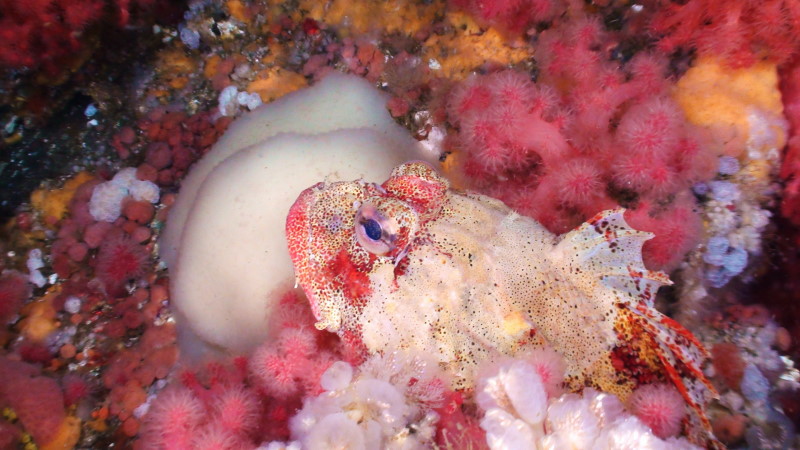
Above this ocean’s cheerful interplay of colors, the wide kelp forests begin, with seaweed of various shades of green swaying in the rhythm of the current.
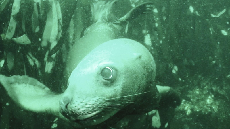
Again and again, Steller sea lions (Eumetopias jubatas), some of the world’s largest sea lions, appeared and curiously inspected the LED illumination of my video camera. This sea lion was named after the German physician and naturalist Georg Wilhelm Steller.
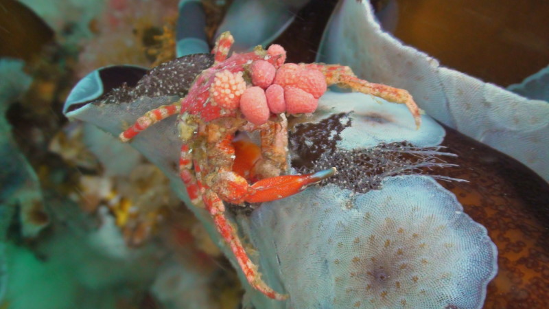
Huge seed shrimps decorated the rocks like pearl necklaces. Sea slugs and feather worms with delicate tentacles were presenting us with almost the whole range of colors, and decorator crabs were sitting everywhere. Everywhere above and below the water surface were organisms just waiting to be discovered. Once a colorful palm sized slug showed up, sometimes a giant pacific octopus came by, or even an orca, humpback whale, minke whale or a porpoise came to visit.
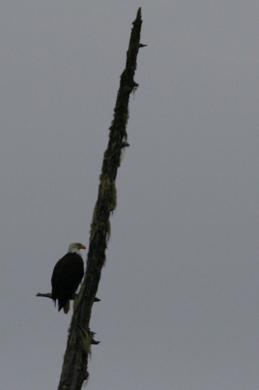
It seemed like that on at least one of every ten trees there was a majestic Bald eagle sitting, which are threatened with extinction in its remaining range. And behind the giant pines, numerous brown and black bears were hiding.
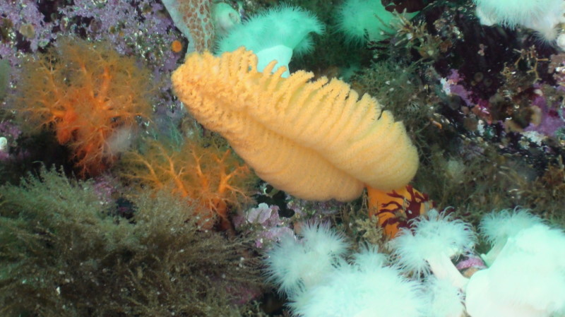
At the bottom of the sea, I admired orange sea pens (Ptilosarcus gurneyi). While you may see a representative of these beautiful creatures in the North Sea, you will find numerous sea pens in Browning Passage that are surprisingly large (~50cm).
While at depth, I could occasionally look into the grimy face of a wolf eel – a peaceful, primeval looking creature.
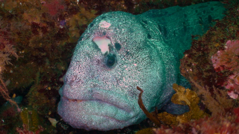
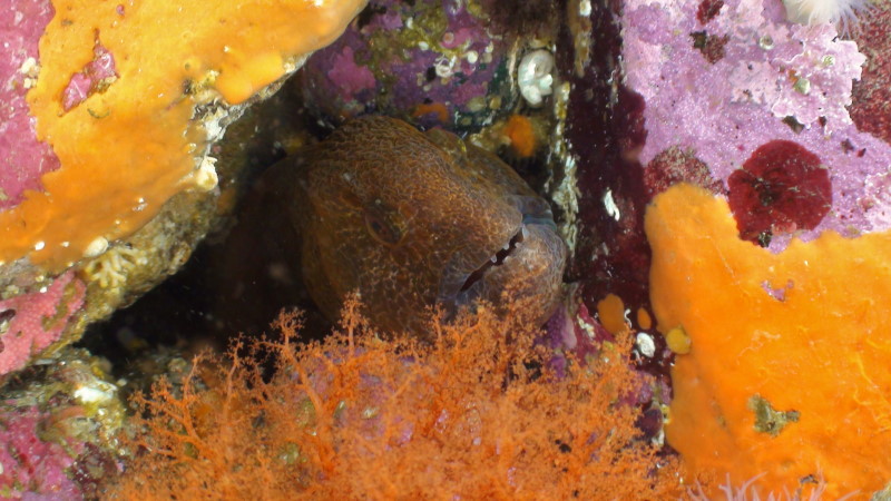
The animal colonies are flourishing here in large numbers because as explained above, the ocean is a giant cocktail of nutrients that is constantly being churned up by tidal currents and surging deep water. A richness of various organisms is clinging to the cliffs or on the ocean floor and only needs to wait for the current to strain plant and animal plankton into their mouth.
Like in the blissful land of plenty, this endless movement of food allows species such as barnacles, which are normally known as 1 cm large organisms, to grow to the size of your palm (Balanus nubilus, 15cm). The crush is feeding a food chain from herring, salmon, orcas, and humpback whales all the way up to the humans.
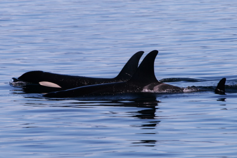
The herring are hunted by local fishermen, mainly for their roe. In the sixties, the herring fishery collapsed due to over fishing. But thanks to the implementation of government quotas, the stocks have been able to recover.
Everything here is huge! Sea anemones (Metridium giganteum, 1 meter), a giant form of our North and Baltic Sea endemic anemone (Metridium senile, 10 cm), the giant shell crabs, lush slugs, oversized king crabs, the giant starfish, sea urchins and sea pens up to the giant pacific octopus at 90 kg. and the largest sea lion in the world, the Steller sea lion, with a weight of up to 1000 kg.
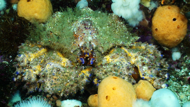
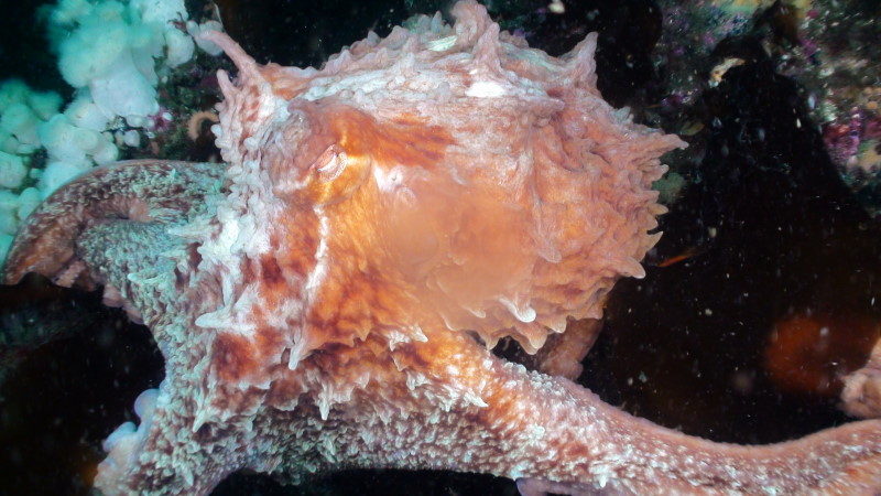
The dive sites here, however, aren’t suitable for beginners. The strong tidal currents and the cold waters of the eastern Pacific make diving close to this small uninhabited island near Port Hardy on Vancouver Island, British Columbia, Canada, both challenging and yet extremely delightful. Because the water is so rich in nutrients for the reasons mentioned above, it offers ideal conditions for an incredible diversity of species and can compete with any tropical dive sites. The rock face of Browning Wall extends about 30 feet above the water surface and almost 70 meters in depth. This drift dive site is only about 100 meters long but with a strong current you could very quickly pass by the glorious drop-off.
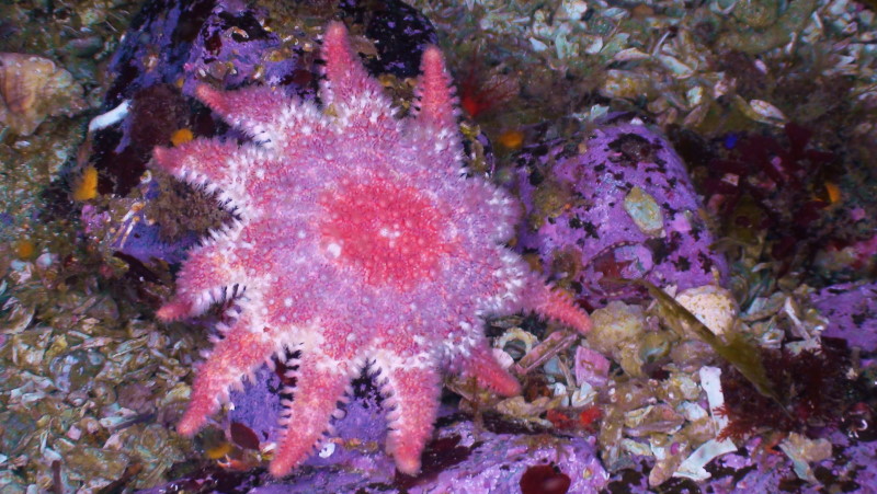
And as for your diving gear – it is the same as for any cold water because the water temperature rarely reaches values of more than ten degrees Celcius, so a dry suit is highly advisable. John gave his ok to dive only after thoroughly studying the tides and current conditions of the dive site.
The Daily Routine:
At 7 am, we had a fairly typical Canadian breakfast consisting of toast, peanut butter, potatoes and sausages. Then we prepared ourselves for the first dive of the day. Thanks to its central location in Clam Cove, no dive spot was more than 20 minutes away by boat. Usually in the morning we enjoyed two dive sites with a surface interval on board between each dive. While on the boat, we were provided with snacks from a small picnic basket that was brought along. The diving from the boat was very comfortable aboard a robust diving boat that cruises reliably through the waters around Vancouver Island.
After the two morning dives, we went back to our floating dive lodge, where we were provided with sandwiches with cheese, sausages, peppers, tomatoes, cucumbers and many sauces, plus a daily fresh soup that quickly warmed up even the coldest parts of the body. Meanwhile, John filled the empty air tanks usually directly on the boat. And the equipment was kept on the boat at all times so there was no inconvenient dragging of the dive equipment during the whole trip.
Only the battery-operated devices which needed new energy had to be moved 5 meters between the boat and the charging station.
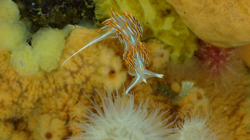
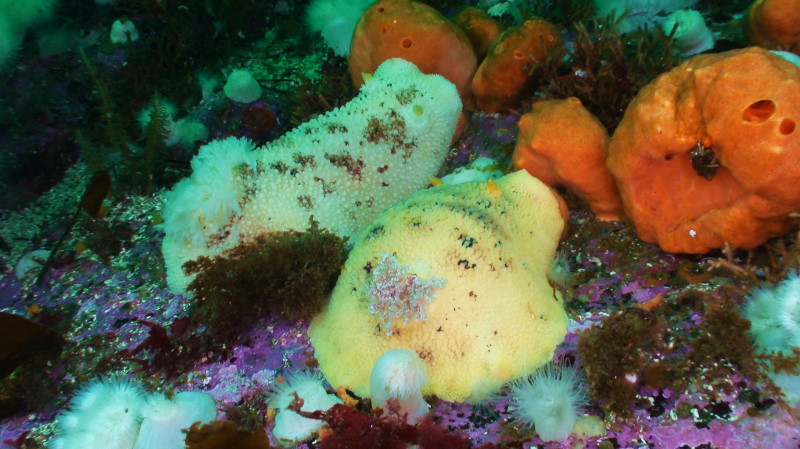
The location of our next dives were dependent on the tide tables. After the fourth dive of the day there was a hearty dinner that always included meat. After dinner, there was always a night dive offered which we gladly accepted.
On returning to the Hideaway, the generator was turned on so our batteries could be recharged. Warm water for a shower was always available throughout the day. After the shower and preparation of our equipment, we gathered each evening around the campfire, shared a drink and reviewed the adventures and impressions of the day’s events. The rooms were functional with large beds that almost filled the entire room. Nevertheless, there was plenty of storage space under the bed and on a shelf in a niche on the wall. The food as described above corresponded to the culture (American/Canadian breakfast, sandwiches, meat-heavy) and was rich and varied. The kitchen cupboards and refrigerators were open to the guests 24 hours/day. So you could enjoy an extra sandwich, cake, tea or coffee at any time.
Located close to Clam Cove are about a dozen of the best diving spots in the region. We dived Hideaway Wall, Hideaway Island, Rock of Life, Eagle Rock, Hussar Point, Snow Fall, Rainbow Reef, The nursery, 7 Tree island, Browning Wall, and the wreck of the Themis. John decided which dive sites to visit each day depending on the wind and tide. The daily briefing proved that John knew the area like the back of his hand, and knows exactly the precise moment of the current change. He also knows the name and position of each king crab …
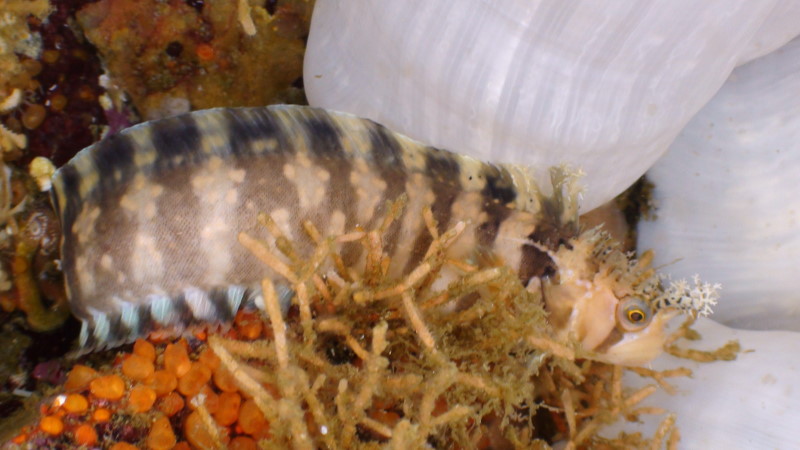
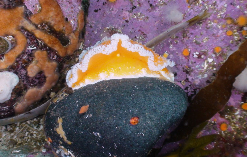
When the generator was off while back at the float camp, there was a wonderful silence. So much so that after a few days you could even hear a fly passing by at 100 meters away. The sea is full of fish and sea birds are constantly dropping to the water surface. There was not a single time that I saw a sea bird leave the water with an empty beak.
Overall, it is a place of silence, of inner retreat and refreshment where one can be lead back to the origins of humanity in an environment that appears untouched and like paradise. Every square centimeter above and below the surface is filled with life. The dive sites are great and the colors of the wall are unreal. Even in the waning summer month of August the visibility was always over 15 meters. The body of the giant white sea anemones made the white balance very easy when taking a picture.
In addition to the diversity of the cold water species their size was also spectacular: octopuses that weighed 90 kg, and sea lions that weighed more than a ton. All of them are nourished by the never ending flow of nutrients from the depths. If you love cold water diving, you will love Queen Charlotte Strait.
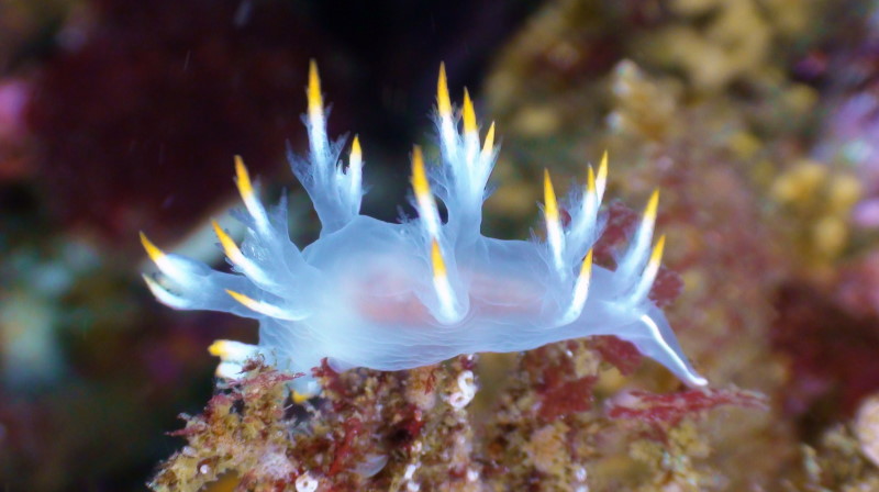
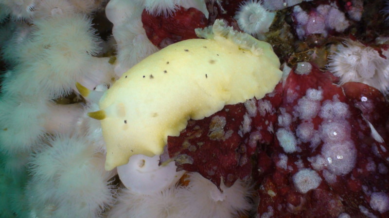
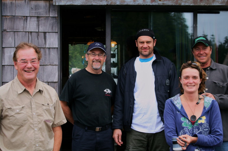
Anyone that doesn’t need a hotel with an entertainment program and Wiener Schnitzel (a typical German national dish) while on vacation will always want to return to the Hideaway and the “best known diving in the universe”.
Generally autumn is recommended as the best time for diving in this area of Canada. From mid-September to early October, the best visibility can be expected and that is when the Hideaway is usually fully booked.
In summer, the visibility can sometimes be reduced by a plankton bloom that may reduce visibility to only 10 meters while in the fall it is often between 20 and 25 meters.
I guess this is why there were only two other guests with me during my stay on the float camp.
Tanks of 10, 12, and 15 liters are available, along with DIN adapters.
Full dive equipment, including dry suit and under garments, can also be rented on site if sufficient notice is given.

